Project Description


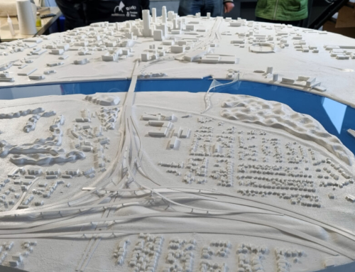
Topographic models are a representation of the earth’s surface and are essential tools used in numerous economic activities, as they are able to offer a valuable perspective on how nature interacts and affects the environment.
Topographic models provide a clear picture of the relief and height differences, they include both natural elements such as mountains, hills, valleys, rivers and others, as well as artificial ones, for example buildings, roads or other components related to infrastructure.
Topographic models are essential tools in numerous industrial sectors, they are a much more precise and easier way to understand the surface of a land compared to a topographic map or a simple image.
Thanks to them, it will be possible to take into account much more effectively the height differences of the land, as well as the prominent elements of the environment, which is definitely an essential step to develop the project in harmony with nature.